Trail info
Main info about the trail
Warnings
Unmarked trail, with parts having 1st degree climbing difficulty. Between the “Casarella” and the chestnut forest, a recent fire and the trunks left along the trail after cutting of the forest oblige you to abandon the original path in more points to search a simpler route. Therefore the trail is only for expert hikers with good orientation skills.
How to get there
The trail begins from "Via Visanola", a narrow pedestrian street in front of the pharmacy of "Via V. Brin", attainable walking from the center of Castellammare di Stabia, along the seafront until to the "Acqua della Madonna" district. Alternatively, the route can be started from the SS 145 (Sorrentina Road) near the Castello Angionino, at the intersection with trails 349b and 336b.Points of interest along the trail
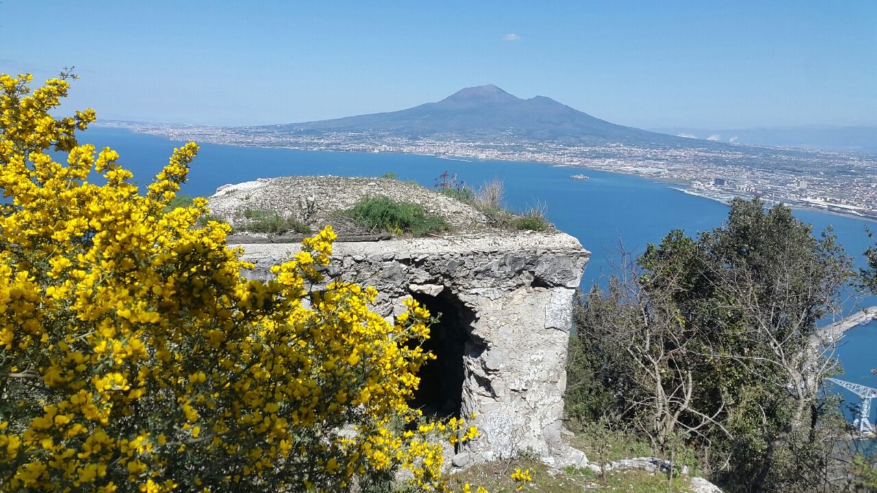
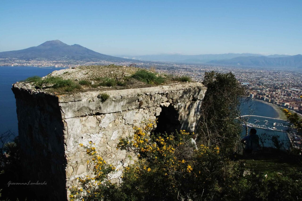
Port of Castellammare (0), Intersection 336b/349b Castello Angioino (125), Intersection 349b Il Campo (726), Intersection 336 Belvedere del Faito (1034)Water points
Acqua della Madonna Piazzale dei Capi (Belvedere)Description
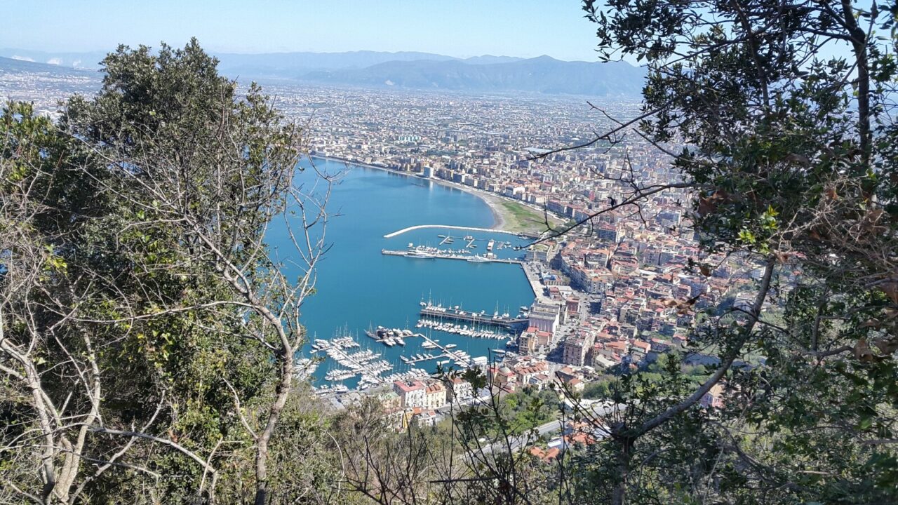
After crossing the ancient center of Castellammare di Stabia, from “Via B.Brin” take “Via Visanola”, a narrow street that runs along the wall of the castle of Castellammare, with a beautiful view on the harbor and the Gulf of Naples.
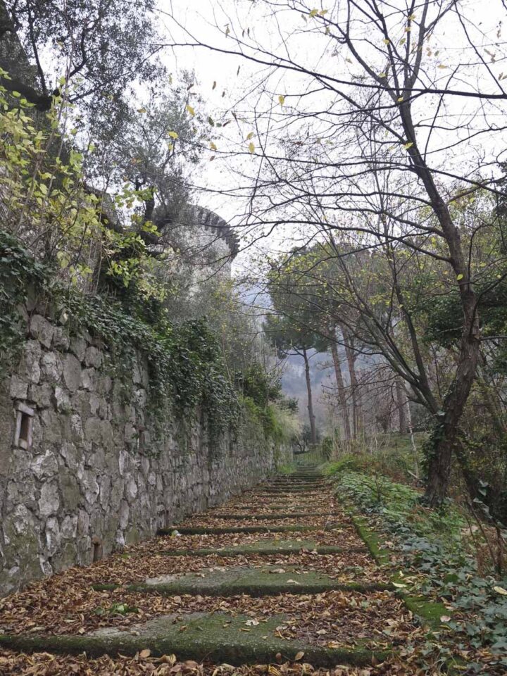
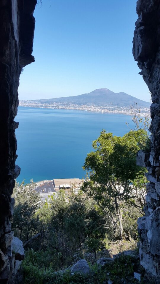
Near the castle cross the “Sorrentina” road and take the service way of the aqueduct for a short stretch, then take the path on the right which leads to the small church of “San Raffaele” in a beautiful strawberry wood. Shortly before reaching the little church you have to go to the left for a narrow path that leads to the eastern ridge of the “Vallone Vena Gatti”, just where is an old stone house called “la casarella o’monte”, a sighting spot used in the 2nd world war. The whole area is rich of myrtle, especially the white one.
Climb the whole easy and panoramic crest without a precise path, then take a narrow path (used by shepherds), crossing some rocky stretches with mountain climbing difficulty of 1st degree, until to reach the path of the chestnut forest.
Walk uphill this forest to get out to the right on the large rocky crest of the “Vallone Scurorillo”, until to reach the asphalt road to Faito coming from Castellammare, just below the “Piazzale dei Capi”.
For the descent you can take the bus or walk downhill for one of the many trails that lead to Castellammare.
From Our Gallery
5 comments
Al lato sinistro del cancello della GORI c’è una grata in legno, apposta da qualche pastore per evitare la dispersione del gregge. Un cordino la fissa al cancello, si raccomanda di scostarla e di rimetterla a posto dopo il passaggio
Bella esperienza per scalatori, ma l'accesso è praticamente bloccato.
Segnalo che al giorno 28.04.23 l’accesso al sentiero sul lato sinistro del cancello della Gori è reso molto difficoltoso da una grata di legno fissata per impedire il passaggio, oltre che la presenza di erba alta. Io sono stato fortunato poiché degli operai che stavano entrando mi hanno permesso di accedere dal cancello.
Per il resto il sentiero è nella media per la prima parte fino alla casarella, poi impenna decisamente fino all’ultimo tratto in cui incrocia la via carrabile di quisisana (la strada Giusso credo). Un solo tratto in arrampicata su roccia è stato più difficile degli altri, ho dovuto necessariamente poggiare il sedere a terra e fare determinati movimenti.
Nella zona del castagneto fate attenzione ai vari animali, greggi e cavalli. Non sono sicuro se c’è qualche cane.
Ho percorso questo sentiero in salita, a maggio 2022. Dal castello fino alla casarella è ben segnato e agilmente percorribile. Il tratto libero non è segnato (ovviamente) e la traccia gps non è percorribile a causa dei lavori di sbancamento adoperati nel castagneto. È comunque percorribile fino in cima usando le rampe che sono state costruite all’interno del castagneto stesso. È stata una bella esperienza perdersi in montagna!
Sentiero chiuso
Col mio gruppo abbiamo provato a percorrere questo percorso. Purtroppo abbiamo dovuto cambiare itinerario in quanto il tratto che parte quasi in coincidenza con la strada panoramica è chiuso con un cancello con l’insegna della Gori, azienda fornitrice di acqua. Abbiamo bussato il citofono ma nessuno ci ha risposto. Avrebbero potuto mettere un cartello con gli orari di apertura e chiusura. Peccato perché avremmo accorciato di molto la salita per raggiungere il Faito.
Ciao, i pedoni possono passare sul lato sinistro del cancello, scavalcando il guard rail. C’è un segno bianco rosso.